Posts

Showing posts from July, 2014

Bealach Feith Nan Laogh

Image
  First of all, having a couple of 'refreshing pints' in the Strontian Inn was a bad idea . . . the hottest day of the year at the fag-end of July, the tarmac bubbling, it seemed wise at the time. The Bealach Feith Nan Laogh could wait a bit. I checked the specs of the climb, which seemed less electrically-shocking at a pub picnic table in the sun: 2.6 km with an average gradient of 11.8% . . .  steep, but no killer, I reasoned. Something at the back of my head crawled and writhed, trying to fathom what higher gradient would average it to 11.8! I clipped into the bike and set off, my mind a fuzzy blank of summer bliss. Turning north off the main road at Strontian towards innocuous-looking hills, the wooded first few kilometres are flat and surfaced with new rolling tarmac, I was in a pleasant dream of cycling paradise, spinning without a chain, listening to birdsong, still on the big ring. A small sign turned me left up a short wooded hill towards 'Pollochro 8m
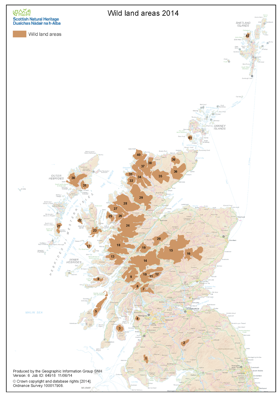
Wild Scotland - new map published by SNH

Image
Scottish Natural Heritage has published its 2014 map of Wild Land Areas of Scotland - designated areas of coast, upland and undeveloped land - or 'wilderness' - which should be considered inviolate. Some of the areas are notably under protection via bodies such as National Parks, the John Muir Trust, or the National Trust and other private bodies, but the worrying note is that since the draft map was published in 2013, 0.8% of wild land has been developed (20.3% down to 19.5%). If it continued at that rate we'd have no wild land left by 2039 . . . The conclusions of the report and mapping were as follows: The concepts of wildness and safeguarding of wild land enjoy strong support from the public and many stakeholders in Scotland. Areas of wild land are widely acknowledged as important assets, providing a number of significant ecosystem services that support a range of social and economic benefits and outcomes.  Despite the inherent subjectivity of the concept, t

Dumby scanning complete

Image
Well, it's done! The Eagle Bloc scanned for full photogrammetry 3D, the crag laser-scanned, some RTI-based imagery of the graffiti and carvings and the Pongo face 3D'd as well. We'll post the results shortly once I figure out the plug-ins for the 3D modelling, but it was an impressive process and my thanks go out to the ACCORD project which initiated this digital heritage of Dumby climbing. We'll archive all the results. Thanks to all who turned up to help: Sven, Alex, John, Eddie and Frank in particular, there was some good storytelling at the Focus group sessions and the weather was terrific throughout to allow for those hundreds of photographs!  The ACCORD group led by Alex Hale, Mhairi Maxwell and Sian Jones  Alex and Sven doing some photogrammetry work on a pole Kevin ignoring us and doing some climbing...the reason for the project