Ben Lawers: a montane habitat
Ben Lawers is the parent peak of the Breadalbane mountain range, which stretches like a breaking wave in an east-west tumble between Loch Tay and Glen Lyon. Indeed, geologists often refer to the metamorphosed schistose mass as a vast 'recumbent fold' from the Caledonian Orogeny, a Highland mountain-building era of unimaginable slow-motion collision and uplift, between 490 and 390 million years ago. The rolling plateau landscape is now a long-eroded echo of this era when continents collided on an earth oblivious to conscious observation. Walking the rubbed-down ridges, it is easy to imagine you are walking the crumpled edge of a fold on the planet's discarded origami.
The summit peak of Ben Lawers is a southern highland giant and the 11th highest peak in Britain. It has many subsidiary peaks on its long snaking ridge, from the south to north-east: Beinn Ghlas (1,103 m); Ben Lawers (1,214 m or 3,983 feet); Creag an Fhithich (1,047 m); An Stuc (1,117 m); Meall Garbh (1,123 m); and Meall Greig (1,001 m). On the flanks of this high ridge, the corries tumble into craggy rich silts and grassy swards. The high Lochan nan Cat is the remnant melt of a glacier bowl at 700m elevation in the eastern bowl under An Stuc, a dirty ice-cube which has long dissolved into an espresso-coloured pool.
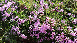
Ben Lawers is managed by the National Trust and is a National Nature Reserve for very good reason, as in summer it explodes into flower with masses of arctic-alpine plants over the 1,000m contour. From the car-park a path leads into the fenced-off gully around the old shieling colonies on the Burn of Edramucky, a fertile defile now full of regenerating montane-willow, birch and alder, and vibrant summer colonies of tormentil, speedwell, avens, hawkweeds, thyme and bedstraw. It is a sheltered haven very distinct from the suddenly exposed corries above, still grazed by sheep to a tolerated degree to allow room for the alpine plants to remain free of the colonial aspirations of other plants. The higher you go, the effect of shearing winds allows only hardy sedges and low alpine plants to grow. The sheep meander between the crags, where great mats of pink moss campion, alpine lady's-mantle and alpine mouse-ear grow, shivering feverishly in the winds but finding a window of light and heat long enough to flower, pollinate and seed. In the snow-churned gullies and on the steeper cliffs you can find hairy rock-cress, alpine forget-me-not, alpine fleabane, roseroot, mountain pansies, and various rare saxifrages.
All mountain ecologies around the planet are undergoing some degree of climate change. Like an ice cube in a glass of water, we can't see the melt directly, but it is happening before our eyes nonetheless. Rational people agree that climate is now more volatile and hotter than any time in recorded meteorological history, and it cannot just be called weather anymore. Anyone observant who has lived more than a few decades will now have noticed environments subtly different to how they first knew them. Many changes in our environment are indisputably due to long anthropogenic influences, to the extent that geologists are tempted to rename this period of the Quaternary beyond the Pleistocene and Holocene epochs as a new 'human epoch' called the 'Anthropocene'.
So what does it mean for our
montane habitats, those mountain biomes above the tree-line where most fast-growing and invasive plants cannot manage to crowd out their more specialised tenants? Recent surveys on
Cwm Idwal in Wales and
Ben Nevis in Scotland, have revealed rare alpine plants moving up the contours to a point they are running out of contours and blinking into local extinction due to a loss of their bespoke habitat requests. Plants such as tufted saxifrage (
Saxifraga cestiposa) and Highland saxifrage (
Saxifraga rivularis) are being restricted to higher corries and inaccessible cliff locations as their snow-screes are colonised and stabilised by warmer winters and more common and aggressive plants.
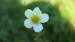 |
| Mossy saxifrage |
 |
| Moss Campion |
 |
| Alpine Forget-Me-Not |
 |
| Highland Saxifrage (Ben Nevis photo) |
 |
| Alpine Mouse-ear |
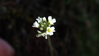 |
Hairy Rock-Cress
|