
Dumby to go 3D!


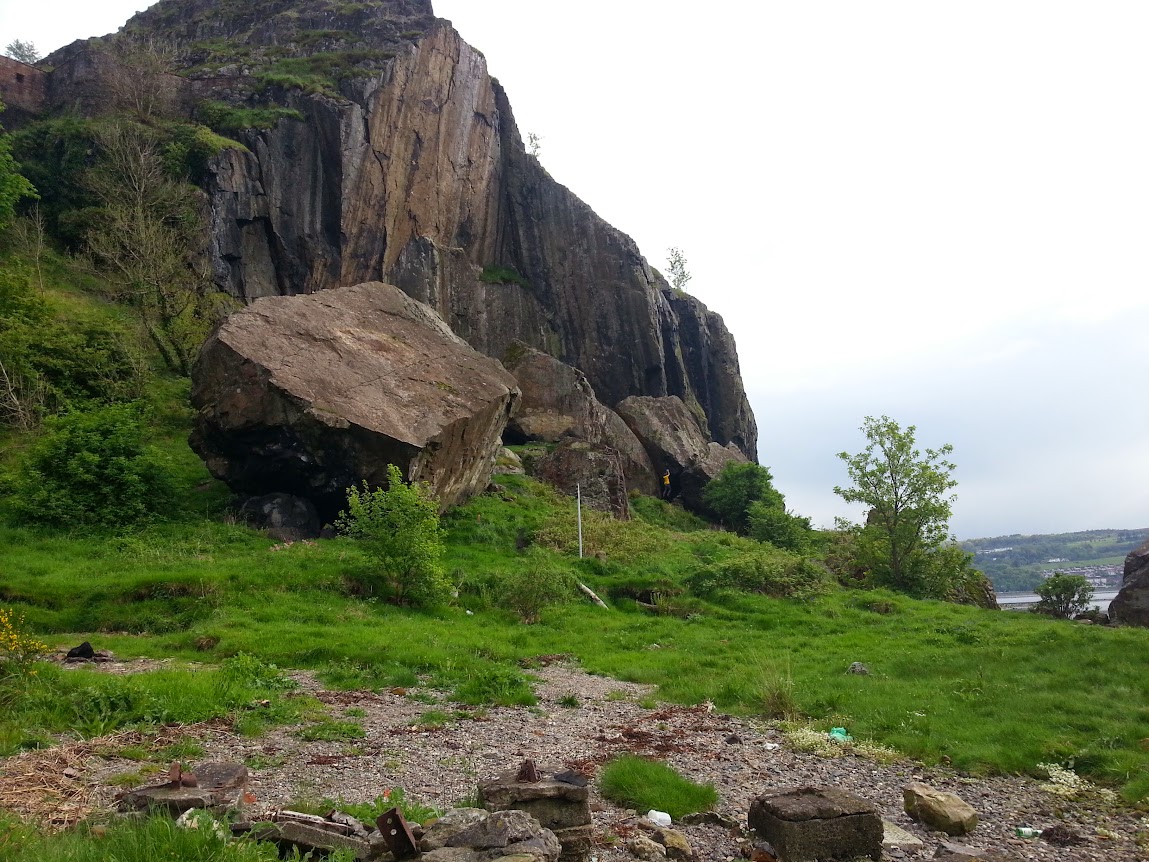
I have been going on for years about Dumbarton Rock being one of our finest examples of modern 'sporting heritage', a kind of living history and an example of community 'ownership' (I use this in the least possessive sense) through simple occupation and use, under the shadow of more static heritage that is purely conservatory (I mean no disrespect to Historic Scotland and the castle!). It's how we create identity after all and is part of the greater weave of history, but seen from the ground-up and the everyday, which is an approach that is gradually displacing the top-down perspective of traditional historiography.

One of the most exciting projects around is a community-history project with the acronym ACCORD, which stands for Archaeology Community Co-Production of Research Data.

What does this mean? Well, for climbers, it means we are gathering a group in early July to photograph the boulders and maybe the crag, with loaned equipment and cameras, to create a 3D collage of all the blocs. When the processing is complete, along with interviews, written material and interpretation, we'll have a full archaeology of our climbing heritage.

We'll also have Creative Commons rights to use the material, imagine a 3D topo! Better still, we'll be able to plug the data into 3D printers and print out our very own Eagle Bloc. Not a bad paperweight to have on your desk at work!

If you want to join in, the dates are from July 7th to 10th, give me an email if you want to know more >>> John Watson

Learn more about the project here >>>
ACCORD is one of eleven projects across the UK to be awarded funding from the Arts and Humanities Research Council’s £4million “Digital Transformations in Community Research Co-Production” programme. Led by the Digital Design Studio of the Glasgow School of Art, the project it is being delivered in partnership with the University of Manchester Department of ArchaeologyArchaeology Scotland and the Royal Commission on the Ancient and Historical Monuments of Scotland. The ACCORD project seeks to examine the opportunities and implications of digital visualisation technologies for community engagement and research through the co-creation of three-dimensional (3D) models of historic monuments and places. Despite their increasing accessibility, techniques such as laser scanning, 3D modelling and 3D printing have remained firmly in the domain of heritage specialists. Expert forms of knowledge and/or professional priorities frame the use of digital visualisation technologies, and forms of community-based social value are rarely addressed. Consequently, the resulting digital objects fail to engage communities as a means of researching and representing their heritage, despite the now widespread recognition of the importance of community engagement and social value in the heritage sector.


Popular posts from this blog

Vertical Landscapes: Exploring Glasgow's Hidden Bouldering

With the new guide to Glasgow Bouldering forthcoming, and with the last two years spent scouring our local landscapes for vertical diversion, many of us discovered a closer, more nuanced appreciation of climbing and how it helps maintain mental wellbeing as much as physical. The big mountains and wilderness landscapes were for the first time excluded from access and our pandemic taught us all to appreciate the landscapes on our doorstep. Even the urban world has its own small wildernesses and landscapes to immerse ourselves in for a while. For me, the daily walk in lockdown occasionally became a hunt for an esoteric piece of rock spied on the OS map or Google Earth. Rumours of boulders and mythologies of obscure rock were hunted down to help feed a hunger for the vertical. Even Dumbarton Rock was out of range, lying outside of the Glasgow City boundary. It's a venue which famously makes the blood run cold, with fiercely exposed overhanging routes, highball boulder problems and cl

The Lost Township of Grulin on Eigg

‘The Stony Place’ as it translates, the archaeological notes on the RCAHMS database for Eigg, state baldly the lost humanity of Grulin as early as an 1880 OS survey map: ‘…eighteen unroofed buildings, six enclosures and a field-system’. Now a scheduled monument and memorialised as a ‘depopulated settlement’, though it is not obvious if the verb is passive or aggressive, Grulin Uachdrach (Grulin Upper) is, like Hallaig on Raasay, a place of violent silence and resonance. Who lived here and why was the site abandoned? If it were not in Scotland, suspicions might fall to the climate, remoteness and apparent unsustainability of the stony place, a rabble of large rocks under the steep slopes of An Sgurr, but the carefully constructed walls tell us it was once a thriving township – the kilns, folds and blackhouse walls integrated with the giant boulders such as Clach Hosdail. In 1853 the whole of the village of Grulin, both upper and lower, housed fourteen families who were forced to l

Timeline Walks of Scotland #Hallaig to Screapadal on Raasay

'Tha tìm, am fiadh, an coille Hallaig ...' Hallaig - the lost village of Raasay - is a powerful place. Arguably, it has become a shibboleth for the soul of Gaelic culture. To visit it, to just be there momentarily and feel the resonance of the place, is to know the fragility of place and home, of how kinship can be shattered and how loss can invade a land. Aptly, Hallaig is now a site of pilgrimage for those who value the universal lessons of history.  There are t errible reasons for the loss of Hallaig. Its silent mouths of abandoned shielings, the dumb sheep meandering amongst the ruins, whisper with Sorley MacLean's poetry. The place misses the sounds of day-to-day community, and all around the woods and burns and slopes this tough but rich landscape once made this a hardy paradise under the eastern cliffs of Raasay. Facing east to the dawn and overlooking the peninsula of Applecross and the berry-dark depths of the Inner Sound, the walk to Hallaig leads quietly